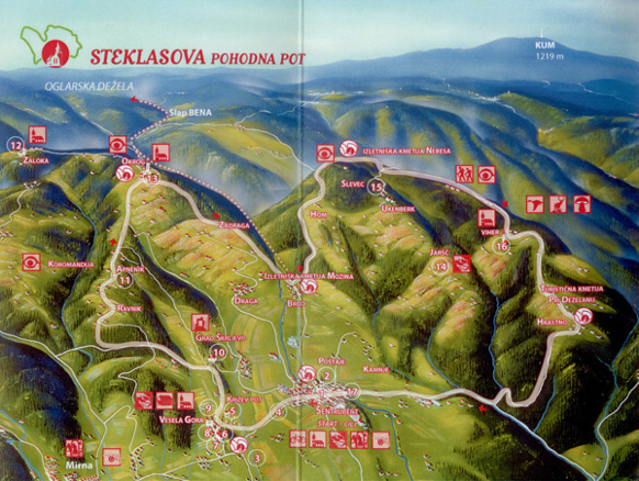
Skip to content- length of route: 20 km,
- walking time: 5 and a half hours of moderate walking,
- best time of year to visit: all seasons, especially spring and autumn,
- trail marking: the Knafeljč marker and direction signs with the Steklas Trail inscription,
- starting point: Šentrupert, square in front of St Rupert’s Church,
- lowest point: Globoko, 268 metres above sea level,
- highest point: Nebesa, 602 metres above sea level,
- difference in altitude: 334 m,
- difficulty: easy,
- the destination of the route: Šentrupert,
- traditional hike: every year, on the second Saturday in October,
- GPS coordinates of the starting point: N 45° 58.374’ E 15° 05.280’